
Orange County is not famous as a hiker’s destination, but there are rich opportunities for chaparral hiker both near the sea and in the mountains and their foothills. You can explore the site of an Indian village, linger in the mists of waterfalls, climb to spectacular vistas, amble in the shade of live oak forests, and witness marvels of geology such as Red Rock Canyon and The Sinks.
This map (which is continually being revised and expanded) marks the better trailheads and features behind the Orange Curtain.
 |
 |
San Francisco Solano
Portola Expedition camp and later site of an assistencia of Mission San Juan Capistrano. Directions |
|
 |
Mountain Goat Vista Point
Views of southwestern Orange County and Irvine Regional Park. Directions |
|
 |
Santiago Oaks Regional Park
Small sage scrub wilderness area with extensive trail system. Directions |
|
 |
Dripping Cave
Locally infamous "Robbers Cave" bearing marks of its former inhabitants. Directions |
|
 |
Canyon View Park
Trailhead for Dripping Cave and other points in Aliso & Wood Canyons Wilderness Park. Directions |
|
 |
Aliso Peak
Headland with a panoramic view of the ocean and Laguna Beach. Directions |
|
 |
Seaview Park
Trail head for the Aliso Peak Trail and the Aliso Rim Trail Directions |
|
 |
Silmod Overlook
The apex of the Silmod Trail, granting views of Irvine Lake and the surrounding countryside. Directions |
|
 |
Bommer Canyon Trailhead
Entrance to the City of Irvine Open Space. Parts only open for special events. Visit http://www.letsgooutside.org. Directions |
|
 |
Four Corners
A popular destination for hikers on the Bear Canyon Trail. You can loop back from here or climb Sitton Peak. Directions |
|
 |
San Juan Loop Trailhead
Entrance to the San Juan Loop and its waterfalls. The San Mateo Canyon Wilderness may also be accessed from her. Directions |
|
 |
Moro Canyon
This and a nearby trailhead lead to the inland portion of Crystal Cove, a sage scrub wilderness. Directions |
|
 |
Hamburger Rocks
One of the scenic features of Crystal Cove State Park. Directions |
|
 |
Santiago Truck Trail
Officially closed, but still used by hikers and bikers. Gateway to Vulture Crags, Fossil Hill, Old Camp, and the Luge Directions |
|
 |
Holy Jim Falls
The famous "chapel in the woods" known to all true residents of Orange County. Directions |
|
 |
Holy Jim Trail
From here you can access the trail to Mount Santiago and Holy Jim Falls. Say a prayer for the last California Grizzly who died near here. Directions |
|
 |
Quail Hill
Gateway to the City of Irvine open space. Some areas closed except on special days. http://www.letsgooutside.org Directions |
|
 |
Coal Mine
The one-time holding of Peter Cole. Found in the Fremont Canyon Nature Preserve. Requires a guide: http://www.letsgooutside.org Directions |
|
 |
Little Yosemite
Rocks that lie on the border between the Fremont Canyon Nature Preserve and the Cleveland National Forest. Directions |
|
 |
Fremont Staging Area
Trailhead for tours of the area north of Irvine Lake. Must be accompanied by a guide: http://www.letsgooutside.org Directions |
|
 |
The Sinks
Part of Limestone Canyon Wilderness Park. Open only on special days. http://www.letsgooutside.org Directions |
|
 |
Agua Chinon Trailhead
Portal to Limestone Canyon including The Sinks and Box Spring. Must be accompanied by guide: http://www.letsgooutside.org Directions |
|
 |
Black Star Canyon
Gateway to Black Star Canyon Falls, Mariposa Preserve, Black Star Indian village site, and Beek's Place. Directions |
|
 |
Tongva-Gabrieliño Village Site
Site of an 1831 massacre of alleged horse thieves by American mountain man William Wolfskill. Directions |
|
 |
Mariposa Preserve
Mariposa Preserve. A nice destination along Black Star Canyon Road. Directions |
|
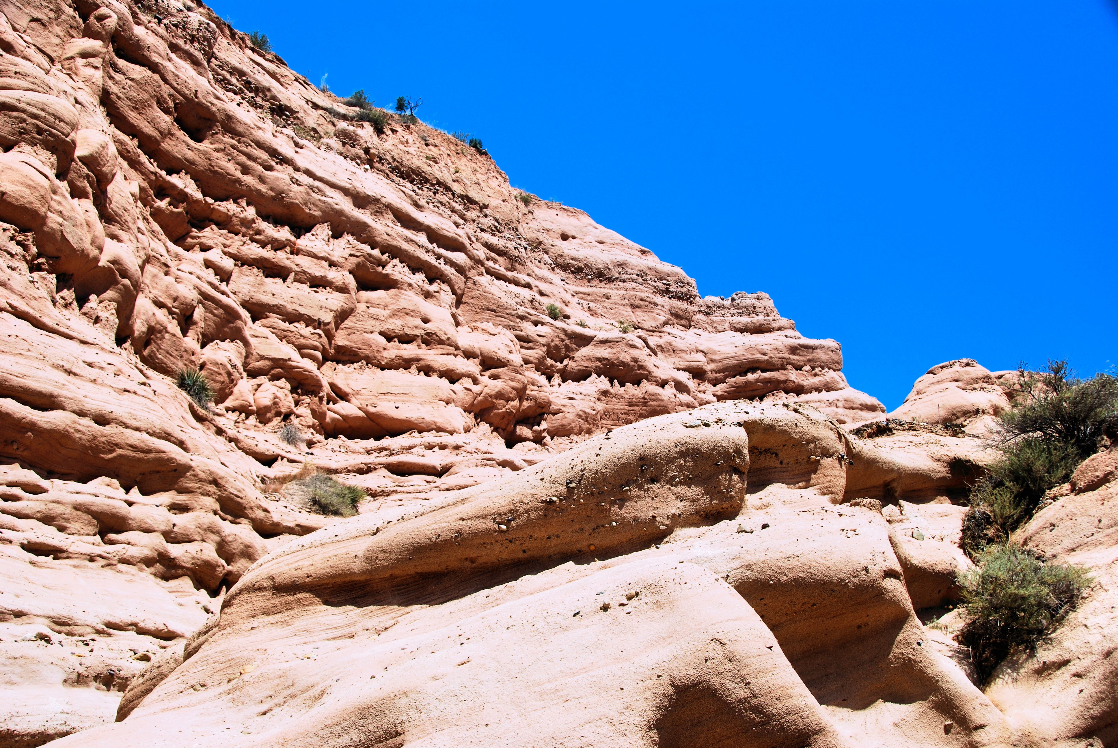 |
Red Rocks
The favorite hikers-only destination in Whiting Ranch Wilderness, a miniature Capitol Reef. Directions |
|
 |
Arroyo Trabuco Trailhead
The trail leads down one of Orange County's longest shaded creek beds. Directions |
|
 |
Vista Point (O'Neill)
Panoramic views of the Saddleback and as far out to sea as Catalina. Directions |
|
 |
Dreaded Hill
Not quite the highest point in Whiting, but a popular destination for hikers and trail bikers. Best approach is from the North. Directions |
 |
 |
Whiting Vista Point
Excellent view of the Red Rocks. Directions |
|
 |
Live Oak Trail
Access to the Vedanta Wilderness and the Vista Point. Unshaded but great views. Directions |
|
 |
Harding Trail
A strenuous trail that runs 11 miles to the Main Divide Road. Shorter hikes include Goat Shed Point and Laurel Springs. Directions |
|
 |
Concourse Park
Access to the east side of Whiting including Sleepy Hollow and Dreaded Hill. Directions |
|
 |
Whiting Ranch, Borrego Trailhead
Best access to the Vista Point, the Red Rocks, and the Billy Goat Trail. Directions |
|
 |
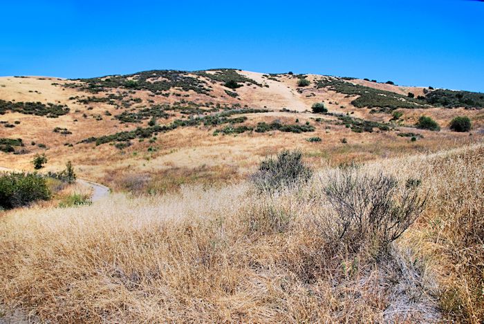
Riley Wilderness
A small park with beautiful grasslands, live oak forests, and sage scrub wild lands. Directions |
