
One short spur trail makes all the difference in the Aliso and Wood Canyons Wilderness Park. When I ascended the Wood Creek Trail to get a view of the canyon beyond, I saw that the trail climbed further and then cascaded down in a series of stairs that I thought would take me back to the main trail. Lynn would not be happy with this country, I realized, so I directed her to go back to the Wood Canyon Trail and wait for me at the first sign she found. The trail — marked “easy” on the maps — dropped into a live oak forest along the creek but where was the main route? The path jumped and swerved along the west bank of the creek — which was fed by water from adjacent housing tracts — over three or four bridges until it finally crossed back and rediscovered the road after about half a mile.
Orange County Parks rules by a strange definition of wilderness. There is no buffer between the suburban and the canyon landscapes. Houses encroach on the very fringes of its wilderness parks. The water on which the plants and wildlife depend comes from the runoff of residential irrigation systems. Concrete aprons permit easy fording of streams. Mountain bikers rocket by with the perennial cry of “On your left! On your left!” Rangers patrol in pickups. A dilapidated wooden corral holds the golden grass that the ranchers seeded to overwhelm the bunch grasses and sedges native to these fields.
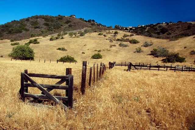
Corral, June 6, 2014
But along the Wood Creek Trail that world was hidden. Lizards darted into the chaparral buckwheat. A brown rodent scurried across the path, too quick for me to fix upon its features to identify it. A loud crash led me to backtrack. Two mule deer grazed among the poison oak on the opposite bank. They had no fear of me unlike the deer I know at Whiting, perhaps because they were comfortable that the stream buffer and steep slopes of the ravine kept me away.
We started this journey at Aliso Viejo’s Canyon View Park and worked our way down the forests and yellow meadows of Wood Canyon to the odd gray lump known as Cave Rock. Wood Creek had been a sheltered side trip — an alternative universe slipped between two hills. Even with mansions tracking their carbon footprints into the park, Nature presented its unique face. A patch of Yerba Mansa (“meek herb”?) waited to be discovered along the roadside. I photographed its white flowers and green cones or “lizard tails” and wondered until I got home whether it was an invasive or a native. (Native.) A covey of quail herded several chicks into the brush as I passed. I saw plenty of lizards.
Cave Rock drooled dry air as we approached it. I walked the loop alone again, which was wise since it traversed a long downwards spine of rock that would have given Lynn problems even with her poles. Impatient walkers had trampled a meadow to get to the main road. A proper junction waited just a few steps beyond and to this I sashayed before following the track where Lynn waited in the shade of the holey promontory.
An even greater crack waited for us at Dripping Cave or “Robber’s Cave” as the disdainful of park maps and Foursquare called it. Teenagers loitered in the gap making it nigh impossible to take a photo of the rift without involving halter tops and short shorts. Our visit was therefore brief: we took the connector to the Mathis Canyon Trail where mosquitoes rose from the laurel-crowded creek bed and came for our eyes, ears, noses, and naked arms. On whim, I swung us onto the Coyote Run. Some sharp, rocky climbs along the edge of a hill slowed us before the trail settled into a sinuous path paralleling the tar-colored waters of Wood Creek. Every few seconds there was a new panic as mountain bikers — usually in multiples of three or four — swarmed the route. Most were gallant and greeted us with genuine civility.
I kept thinking, however, about how their presence changed a trail. Whiting’s Sleepy Hollow, for example, had once been limited to foot traffic. After the 2008 Santiago Fire, the rangers decided to open it up to mountain bikers. What had once been a pleasant amble among live oaks and sycamores became a scramble anytime bikers came through. Coyote Run could be a pleasant place, I imagined, if one did not have to squeeze to the sides to let bikers through. The brown triangle at either end of the trail signaled that bikers were to give way to hikers, but in practice hikers had to jump off the narrow groove to allow a horde of cycles to pass.
The number of cyclists dwindled as we neared the junction with the Wood Canyon Road. Here in a final wood I saw a Spotted Towhee bouncing through the scrub. I heard other songs and thought that I should record them for identification later. Lynn caught up at the bridge spanning the creek and we climbed together to the neighborhood park where our car was waiting in the shade.
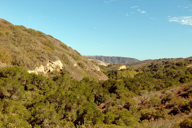
Wood Canyon, July 6, 2014
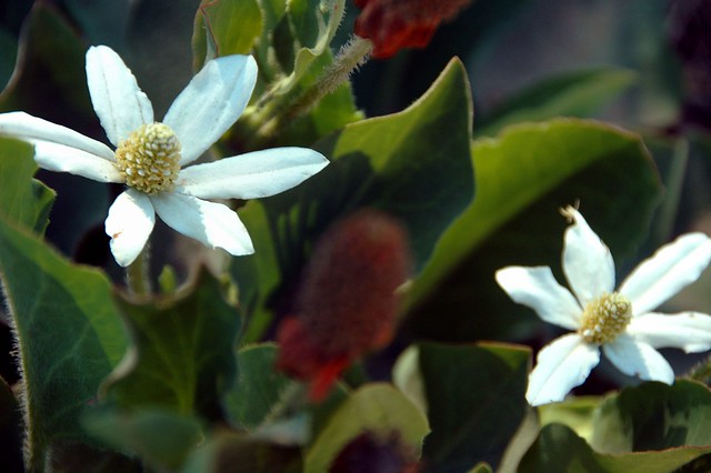
Yerba Mansa, July 6, 2014
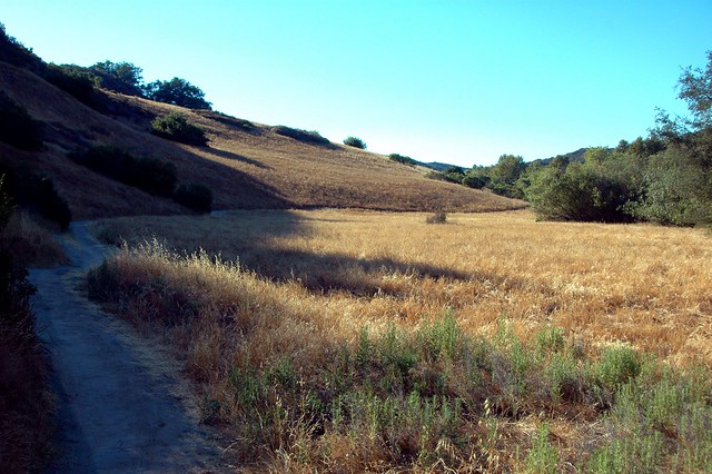
Coyote Run, July 6, 2014
