Tag Archives: description

Seeking The Green Sea Turtles of the San Gabriel River

Sea Turtle Mark

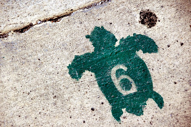
Sea Turtle Trail Mark

We were off to see the turtles, the green sea turtles of the San Gabriel River. A pair of power plants spewing warm water created an ideal temperature that brought the chelonians north, far from the tropical waters where they spawned. Their existence had been dismissed as cryptobiology until a team from the Aquarium of the Pacific arrived at the spot and confirmed that they were the real thing come for a spa. Lynn and I had seen sea turtles or honu in Hawaii. This was our first attempt to view them closer to home.

Continue reading

  • Share on Tumblr

Bland Country

Peaceful Valley

Peaceful Valley with Camp Pendleton in the background

“You’re the first person we’ve seen on this trail this afternoon,” I said to the mountain biker riding toward me.

“There’s a woman hiking alone back there,” he said.

“That’s my wife,” I said. “We’re turning back.” I put my walkie talkie to my mouth and gave Lynn the news. We’d done enough of this trail. The sun was beginning to come down and there was just more of the empty sage scrub and dead meadows that had accompanied our footsteps from the start of our walk in the back country portion of San Onofre State Beach.

Continue reading

  • Share on Tumblr

The Summer Desert of Santiago Oaks

Walking Grasshopper Ridge

Walking Grasshopper Ridge

We’d never been to Santiago Oaks Regional Park even though we’d lived only half an hour away, so we laded ourselves with plenty of water and drove down Santiago Canyon Road to find it. After nearly missing the turn, we followed a confusing set of bends through a wealthy neighborhood that brought us to the main gate and the parking lot.

Eucalyptuses dominated the forest. Pines and a couple of exotics that I did not recognize filled much of the space. Laurels and sycamores thronged the wash. Oaks seemed scarce aside from a few oft-photographed trees along the Santiago Creek Trail and a few youngsters planted as part of a restoration project.

Continue reading

  • Share on Tumblr

Going Down to Aliso Peak

Aliso Peak:  Bench Mark

Aliso Peak: Bench Marker, July 13, 2014

Lynn and I decided we needed a short hike after our storming of Black Star Canyon the day before, so we headed down to Laguna Niguel and parked the car at Seaview Park for the downhill walk to Aliso Peak.

Yes, you read that right.

Lynn asked me a second time if I was sure about what the guidebook had said.

“Yes, it is downhill,” I said.

“How do you do that?”

“You’ll see.”

Continue reading

  • Share on Tumblr

Going in Circles in Black Star Canyon

Rocks along Silverado Creek Trail

Rocks Along the Silverado Creek Trail, July 12, 2014

It was my intention to arrive early before other hikers obliterated the tracks of the previous night, but my punctuality didn’t help: at least one docent preceded me and other walkers passed me so there was nothing to see other than scat by the time I scanned the trail. Saturday offered another open access day on which the general public could explore the lands to the east of Black Star Canyon Road. We picked up our lime green passes at the registration table, walked up the road, and started our journey into the dry forest of Baker Canyon. Eucalyptus gave way to live oaks and sycamores as we marched further in. Baker Meadow was lovely even with the dead grass. Coyotes were eating some kind of pitted fruit — the cactus hadn’t ripened yet so it wasn’t that — and leaving purplish mounds in the middle of the path. We lost the forest canopy and trudged up the Hall Canyon Trail — a hard climb that led to a mercy of switchbacks and a crest over which we passed to get to the flood plain of Silverado Creek.

Continue reading

  • Share on Tumblr

Strange Wilderness

One short spur trail makes all the difference in the Aliso and Wood Canyons Wilderness Park. When I ascended the Wood Creek Trail to get a view of the canyon beyond, I saw that the trail climbed further and then cascaded down in a series of stairs that I thought would take me back to the main trail. Lynn would not be happy with this country, I realized, so I directed her to go back to the Wood Canyon Trail and wait for me at the first sign she found. The trail — marked “easy” on the maps — dropped into a live oak forest along the creek but where was the main route? The path jumped and swerved along the west bank of the creek — which was fed by water from adjacent housing tracts — over three or four bridges until it finally crossed back and rediscovered the road after about half a mile.

Orange County Parks rules by a strange definition of wilderness. There is no buffer between the suburban and the canyon landscapes. Houses encroach on the very fringes of its wilderness parks. The water on which the plants and wildlife depend comes from the runoff of residential irrigation systems. Concrete aprons permit easy fording of streams. Mountain bikers rocket by with the perennial cry of “On your left! On your left!” Rangers patrol in pickups. A dilapidated wooden corral holds the golden grass that the ranchers seeded to overwhelm the bunch grasses and sedges native to these fields.

Corral

Corral, June 6, 2014

Continue reading

  • Share on Tumblr

Bear Canyon Eternities

“You know,” I said to the man with only a water bottle on the last stretch of the Bear Canyon Trail, “this is the longest 1.1 miles I have ever walked. It never seems to end.”

“I was thinking the same thing,” he said.

“I’m not even halfway there,” I cried.

“No, Four Corners is just ahead.”

So it was. I walked into the sparsely seeded meadow where the trails met just a couple of minutes later. The view amazed me: mile upon miles of uncut, unburnt chaparral. The elfin forest grew upwards to twenty or more feet on either side of the trail. Chamise blossomed at the edges of the open tract, offering itself as a foreground subject for every photo I took.

Bluewater Canyon from 4 Corners

Bluewater Canyon from Four Corners, Cleveland National Forest


Continue reading

  • Share on Tumblr

Quail Hill and Fox Run

Rocks Along the Quail Hill Trail

Outcropping Along the Quail Hill Trail, June 18, 2014

The chaos of rocks offered a challenge that proved too formidable for me. I can handle steep hills as long as I can set a steady pace. Fox Run’s boulders gave me no quarter, no opportunity for rhythm, no chance to stop and enjoy the view. The whole of my concentration was given to getting around the next stony protuberance. So I struggled, resting between outcrops to gather my strength and sweating like I was in Miami. When I conquered the last and relatively easy third of the trail — which was precipitous but smooth — I felt nauseous. Some kind of problem — maybe blood sugar, maybe dehydration — tormented me and I could blame that problem on the path I had just clamored up. Unequivocally.

Continue reading

  • Share on Tumblr

Wavy Water

Our midweek adventure — a scheduled event of the Irvine Ranch Natural Landmarks conservancy — took us four and a half hours to finish, counting the short breaks at The Sinks and Box Spring. The trail began at a notorious local dead end. We followed the water lines up Agua Chinon (“wavy water”) Canyon with no real trouble until we hit a steep loma as hellish as the south slope of Whiting’s Dreaded Hill. The summit brought us face to face with the western section of The Sinks

An inland sea or lake deposited the layers that appear in The Sinks formation about 40 million years ago. A long period of wet weather — sometime in the last million years — super-saturated the hills and caused the looser soil to slide away. The badland that was left exposed layers of harder red and white sediments that draw hikers and bikers to special “open days” at the Limestone Canyon Wilderness Park.

The Sinks

The Sinks from the Observation Deck, June 11, 2014


Continue reading

  • Share on Tumblr

Wagon Wheel Loop

Thomas F. Riley Wilderness wasn’t very big: we rounded the loop in under two hours despite the heat. The park’s bottom lands were covered by some fine live oak forests offering cool shade and thick with poison oak. Much of our route, though, was through open grasslands where the sun burned through our hats. The best part of the journey was the trail end known as Skink Point. The interpretive sign directed you to look at the Santa Ana mountains, but I found the best view lay behind us:

Riley Wilderness:  Skink Point Vista

Skink Point Vista


Continue reading

  • Share on Tumblr