It was my intention to arrive early before other hikers obliterated the tracks of the previous night, but my punctuality didn’t help: at least one docent preceded me and other walkers passed me so there was nothing to see other than scat by the time I scanned the trail. Saturday offered another open access day on which the general public could explore the lands to the east of Black Star Canyon Road. We picked up our lime green passes at the registration table, walked up the road, and started our journey into the dry forest of Baker Canyon. Eucalyptus gave way to live oaks and sycamores as we marched further in. Baker Meadow was lovely even with the dead grass. Coyotes were eating some kind of pitted fruit — the cactus hadn’t ripened yet so it wasn’t that — and leaving purplish mounds in the middle of the path. We lost the forest canopy and trudged up the Hall Canyon Trail — a hard climb that led to a mercy of switchbacks and a crest over which we passed to get to the flood plain of Silverado Creek.
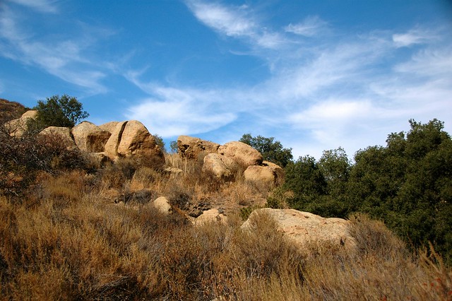
Lynn charged ahead on the uphill and struggled to keep up with me as her knees betrayed her on the downhill. I kept backtracking until I saw her then turned and continued down the slope. The chaparral was thick and dry. Dry tubes of chamise flowers poked from the edges of the dirt road. A stand of fuzzy-leaved Yerba Buena waited for us on the flat where we turned onto the Silverado Creek single track. I liked this section the best even though it lacked shade. There were interesting rocks that I might not have noticed had it not been for a middle-aged Japanese gentleman coming in the opposite direction who stopped to take a picture. The docents warned against trail cutting, but at one spot I disobeyed the edict to examine a place where a seasonal spring had cut through a boulder. A crude artist found this isolated place long ago and carved his initials in the sandstone.
The trail dived and soared without warning. The best part came when the sage scrub gave way to a broad meadow that I made a note to see in the spring. I found some hairy logs of mountain lion scat on its edge. Few animals passed that much. “Do they get hairballs?” I wondered.
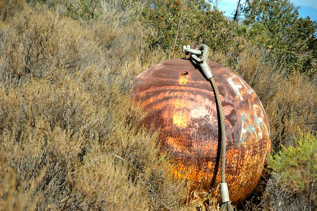
The question lingered in my mind as we climbed to the Helo (pronounced “hee-low” not “hello”) Trail and took a left. We paused to contemplate the mystery of a large metal sphere standing in the brush before circling back to the Baker Canyon staging area where we had started this leg. I had not had enough, so I persuaded Lynn to join me in exploring the northern loop. A wooden bridge bore us across a dry creek and onto the Silmod Trail.
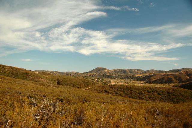
The larger north end of the preserve had only this one trail. Its vistas included Irvine Lake, the red rocks along Santiago Creek, a scraped area reserved for heavy construction equipment, and a gigantic rock outcropping surmounted by an oversize cross. There’s no access to any of these areas from the park, especially the cross which was surrounded by an electric fence. The barrier exists, I hazard, to keep people from desecrating an area that the church uses for maybe two days a year. Perhaps the rumors of Devil Worshipers who defile Black Star Canyon with their unholy rites unsettled the pastor and his parish council. The sad result was that the best part of the surrounding country was off limits to secular visitors or leveled into a parking lot or crossed by unsightly power lines and electrical towers.
The Silmod Trail began on a prairie and ended at a shaded gate on Black Star Canyon Road. In between these two places, the trail ascended an elevation in a gentle curve before falling down some easy if rapid switchbacks. Coyote tracks in the dust signaled the loneliness of the northern loop. We followed them for a hundred yards until they darted off into the brush.
For once, I led the way on the slope. Lynn staggered up the grade — she’d had too little water before she’d left.
Overheating can erase a landscape from your mind. You pay more attention to the dust in front of you and the next scrap of shade than you do to the scenery.
A pair of docents on horseback cautioned us because they saw me sweating and Lynn struggling toward the top. I felt fine, but I agreed to keep an eye on my wife. I kept her moving by giving her progress reports on how far we had yet to climb. “It’s not far now.” “I can see the junction.” Etc.
A few minutes after we said our goodbyes to the volunteer rangers, we arrived at the top and drank as much water as we could from our Camelbaks as we admired the silver waters of Irvine Lake. From this point and nearly all the way to the bottom, that shine dominated every angle. A couple who joined us at the top after coming from the other direction told us that they had seen deer. I saw none, but I saw their tracks mixed with boot prints, coyote spoor, and mountain bike treads.
The way down took us through sage scrub. A single stretch of shade beneath an opposing pair of oaks gave us another chance to suck on our Camelbaks before we passed a party of bikers and found ourselves on the last stretch. A ranger checked our green badges, opened the gate, and asked us if anyone was following us. We turned down Black Star Canyon Canyon Road, aware of the brilliance of the chaparral on our left and the darkness of the landscape on the right. Mare’s tails blew in from the ocean as the sun started to set. A gentle breeze cooled my sweat-soaked t-shirt. Home — the place with the comfortable chairs — was less than half an hour away.
DIRECTIONS: Black Star Canyon Wilderness Park is under the supervision of the Irvine Ranch Conservancy. You can sign up for open access days and other events at http://www.letsgooutside.org. They will send you directions when you sign up.
ROUTE: The route we took began at the Baker Canyon entrance to the park. We followed the Baker Meadow Trail to Hall Canyon/Helo Trail. We went over the crest past the Helo Trail and then down Hall Canyon. The Silverado Meadow is a single track sneaking off the dead end of Hall Canyon. Follow this to the Helo Trail and then circle back to the Baker Canyon staging area where you can take a bathroom break. Follow the Axelrod Trail out of the staging area to Baker Meadow and then cross the wooden bridge when you come to it to start on the Silmod Trail. This road will take you to a scenic overlook where you can see Irvine Lake and the hills of the Limestone Canyon Wilderness Park. Take the single track down to Black Star Canyon Road and follow that back to your car.


