Prickly Pear at Sunset

Lynn has been out of town in observance of her mother’s eightieth birthday for the past several days so I had a weekend to fill. Going to hiking meetups seemed the thing. The first one taught me the importance of carefully noting the meeting place. Just because a prominent trail begins in a county park, do not assume that the members will gather there or that you will hike the whole length of the trail. The Arroyo Trabuco trailhead that I know lies in O’Neill Regional Park. I arrived there shortly before the departure time to find the lot empty except for a sports car and an oversized pickup truck. Only a couple of bikers on their way back from a ride lingered at the beginning so I wondered if I had chosen the wrong date or time. The network was thankfully connectible, so I installed the Meetup app and discovered that I was there at the right time, but — this took awhile to sink in — at the wrong place. The organizer had chosen a spot two and a half miles away, so I hoofed it over a path thick with stones the size and shape of prehistoric eggs until I caught up with the other hikers — who were on their way back.
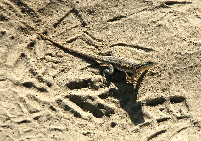
Great Basin Western Fence Lizard, O’Neill Regional Park, June 21, 2014
Started a nature journal today. Here is what I did: First, I purchased a notebook that I liked. The brown leather cover contrasted with the black moleskines I had purchased for other purposes. The only mistake that I made in retrospect was that I bought ruled pages instead of graphs. Graphs made it easier to draw maps and pictures. Photos from my camera would have to suffice for many things.
When I arrived at the place where I began my walk, I noted the time, the temperature, and the elevation. My GPS’s batteries had died after a long dormancy, so I resorted to a Samsung Galaxy app called “S Baro” which gives you the elevation within fifty feet based on the barometric pressure. I also made a mental note to put fresh batteries in the GPS.
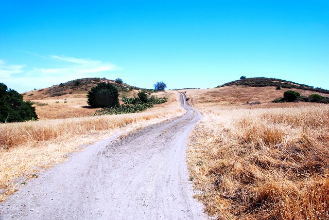
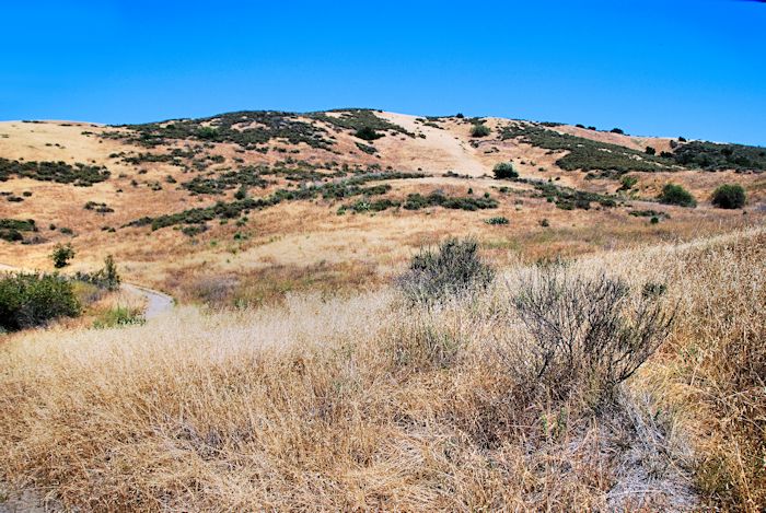
I took a break from Whiting Ranch to explore the season at nearby O’Neill Regional Park, specifically the Live Oak, the Hoffmann Homestead, and the Vista Trails, a lariat that I began at the corner of Meadow Ridge and Chisolm Trail in Mission Viejo. Summer is the season of death here in Orange County. Memorial Day weekend marks the final demise of the foxtail and wild oat grasses. Gone are the Golden Stars, the mustard, and other competitors for the sun of the open range. The country turns resplendent yellow except for dusky patches of sage, toyon, and chamise creating a pattern on the hills.
Vedanta Wilderness, O’Neill Regional Park, California
Few things can be more frustrating that to aim your eye through your camera’s viewfinder and discover that its battery has died just as a brilliant vista comes into view. This happened to me as I surmounted the hill near the Vista Point and looked down on the Live Oak Trail as it plunged down one slope and crawled up the long ridge that rises after the junction with the Coyote Trail. I sighed and contained a tantrum by remembering that I had my Samsung S5 in my pocket. It couldn’t compete with my Nikon, but it was better than nothing.